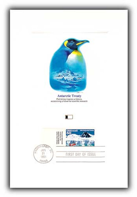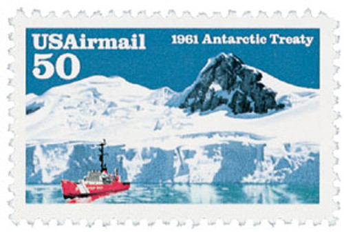
# C130 FDC - 1991 50c Antarctic Treaty
1991 50¢ Antarctic Treaty
First City: Washington, D.C.
Quantity Issued: 113,000,000
Printed by: Stamp Ventures
Printing Method: Photogravure
Perforation: 11
Wilkes Expedition Discovers Antarctica
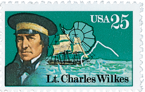
On January 19, 1840, US Naval captain Charles Wilkes became the first American to explore the coast of Antarctica.
Born on April 3, 1798, in New York City, New York, Charles Wilkes joined the US Navy in 1818. In the 1820s he was part of the Columbian Institute for the Promotion of Arts and Scientists. And in the 1830s, his survey of Narragansett Bay earned him a promotion to head of the Navy’s Department of Charts and Instruments, where he developed the Naval Observatory and Hydrographic Office.
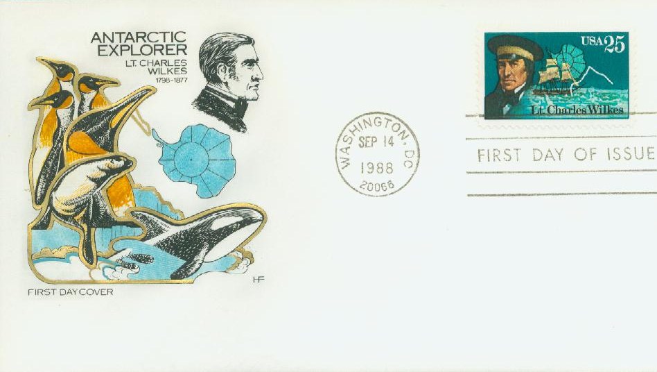
As early as 1828, President John Quincy Adams had wanted to send a naval surveying expedition to the Antarctic Ocean. At the time, ships traveling to the Antarctic in search of whales, seals, and fish were wrecked because the area was uncharted. Despite these concerns, Congress wouldn’t award the funding. It wasn’t until 1836, under President Andrew Jackson, that funding was finally granted, though the project would stall again until President Martin Van Buren pushed for it while in office. Due to the long delay, the original commanding officer resigned, and Wilkes was selected due to his experience with hydrography, geodesy, and magnetism. Naturalists, botanists, a mineralogist, taxidermists, artists, and a philologist joined Wilkes.

The fleet of six ships departed Virginia on August 18, 1838. They traveled down the coast of South America to the Pacific, through the Polynesian islands and on to Australia. Heading south after leaving Sydney, Wilkes saw a wall of ice and directed his ships toward it.

On January 19, the expedition sighted land, which Wilkes called Cape Hudson. Up until that time, there was little information about that part of the world, and it was left blank on most maps. Though whalers traveled the waters near Antarctica, no one had mapped out the land. While explorers from other nations had spotted small areas of land there before, none had explored it as widely as Wilkes would.
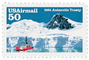
Once he saw land, Wilkes followed along the shore as closely as possible, being ever careful as the water was filled with icebergs. After sailing for several more days and spotting land a few more times, Wilkes concluded that what he was seeing was a continent (previous sightings believed they simply saw a series of small islands) and named it the Antarctic Continent. Wilkes continued to follow along the coast for nearly a month. During that time, the cold and conditions were so bad that his crew and doctors warned that they should turn back, but Wilkes was adamant about completing his mission. Finally on February 21, after a month of skirting the coast for over 1,500 miles, he believed he had achieved his goal of exploring the Antarctic and agreed to head north.

The expedition continued for another two years after that. By the time they returned to America in June 1842, they had circumnavigated the globe, traveling nearly 87,000 miles. Their journey included the Madeira Islands, Rio de Janeiro, Tierra del Fuego, Chile, Peru, Samoa, New South Wales, the Balleny Islands, Fiji, the Philippines, Singapore, Polynesia, and many other areas. The expedition is credited with playing a significant role in the development of 19th-century science, and in particular the growth of America’s scientific establishment. The crew collected thousands of plant and animal specimens that were later made part of the Smithsonian Institution collection. Additionally, Wilkes’ 19-volume report gave detailed information on the customs, politics, and economies of the far-away places they had explored.
Click here to read Wilkes’ report online.
1991 50¢ Antarctic Treaty
First City: Washington, D.C.
Quantity Issued: 113,000,000
Printed by: Stamp Ventures
Printing Method: Photogravure
Perforation: 11
Wilkes Expedition Discovers Antarctica

On January 19, 1840, US Naval captain Charles Wilkes became the first American to explore the coast of Antarctica.
Born on April 3, 1798, in New York City, New York, Charles Wilkes joined the US Navy in 1818. In the 1820s he was part of the Columbian Institute for the Promotion of Arts and Scientists. And in the 1830s, his survey of Narragansett Bay earned him a promotion to head of the Navy’s Department of Charts and Instruments, where he developed the Naval Observatory and Hydrographic Office.

As early as 1828, President John Quincy Adams had wanted to send a naval surveying expedition to the Antarctic Ocean. At the time, ships traveling to the Antarctic in search of whales, seals, and fish were wrecked because the area was uncharted. Despite these concerns, Congress wouldn’t award the funding. It wasn’t until 1836, under President Andrew Jackson, that funding was finally granted, though the project would stall again until President Martin Van Buren pushed for it while in office. Due to the long delay, the original commanding officer resigned, and Wilkes was selected due to his experience with hydrography, geodesy, and magnetism. Naturalists, botanists, a mineralogist, taxidermists, artists, and a philologist joined Wilkes.

The fleet of six ships departed Virginia on August 18, 1838. They traveled down the coast of South America to the Pacific, through the Polynesian islands and on to Australia. Heading south after leaving Sydney, Wilkes saw a wall of ice and directed his ships toward it.

On January 19, the expedition sighted land, which Wilkes called Cape Hudson. Up until that time, there was little information about that part of the world, and it was left blank on most maps. Though whalers traveled the waters near Antarctica, no one had mapped out the land. While explorers from other nations had spotted small areas of land there before, none had explored it as widely as Wilkes would.

Once he saw land, Wilkes followed along the shore as closely as possible, being ever careful as the water was filled with icebergs. After sailing for several more days and spotting land a few more times, Wilkes concluded that what he was seeing was a continent (previous sightings believed they simply saw a series of small islands) and named it the Antarctic Continent. Wilkes continued to follow along the coast for nearly a month. During that time, the cold and conditions were so bad that his crew and doctors warned that they should turn back, but Wilkes was adamant about completing his mission. Finally on February 21, after a month of skirting the coast for over 1,500 miles, he believed he had achieved his goal of exploring the Antarctic and agreed to head north.

The expedition continued for another two years after that. By the time they returned to America in June 1842, they had circumnavigated the globe, traveling nearly 87,000 miles. Their journey included the Madeira Islands, Rio de Janeiro, Tierra del Fuego, Chile, Peru, Samoa, New South Wales, the Balleny Islands, Fiji, the Philippines, Singapore, Polynesia, and many other areas. The expedition is credited with playing a significant role in the development of 19th-century science, and in particular the growth of America’s scientific establishment. The crew collected thousands of plant and animal specimens that were later made part of the Smithsonian Institution collection. Additionally, Wilkes’ 19-volume report gave detailed information on the customs, politics, and economies of the far-away places they had explored.
Click here to read Wilkes’ report online.


