


1926 9c Jefferson, rose
# 590 - 1926 9c Jefferson, rose
$2.50 - $1,125.00
Write a Review

Write a Review
590 - 1926 9c Jefferson, rose
| Image | Condition | Price | Qty | |
|---|---|---|---|---|
|
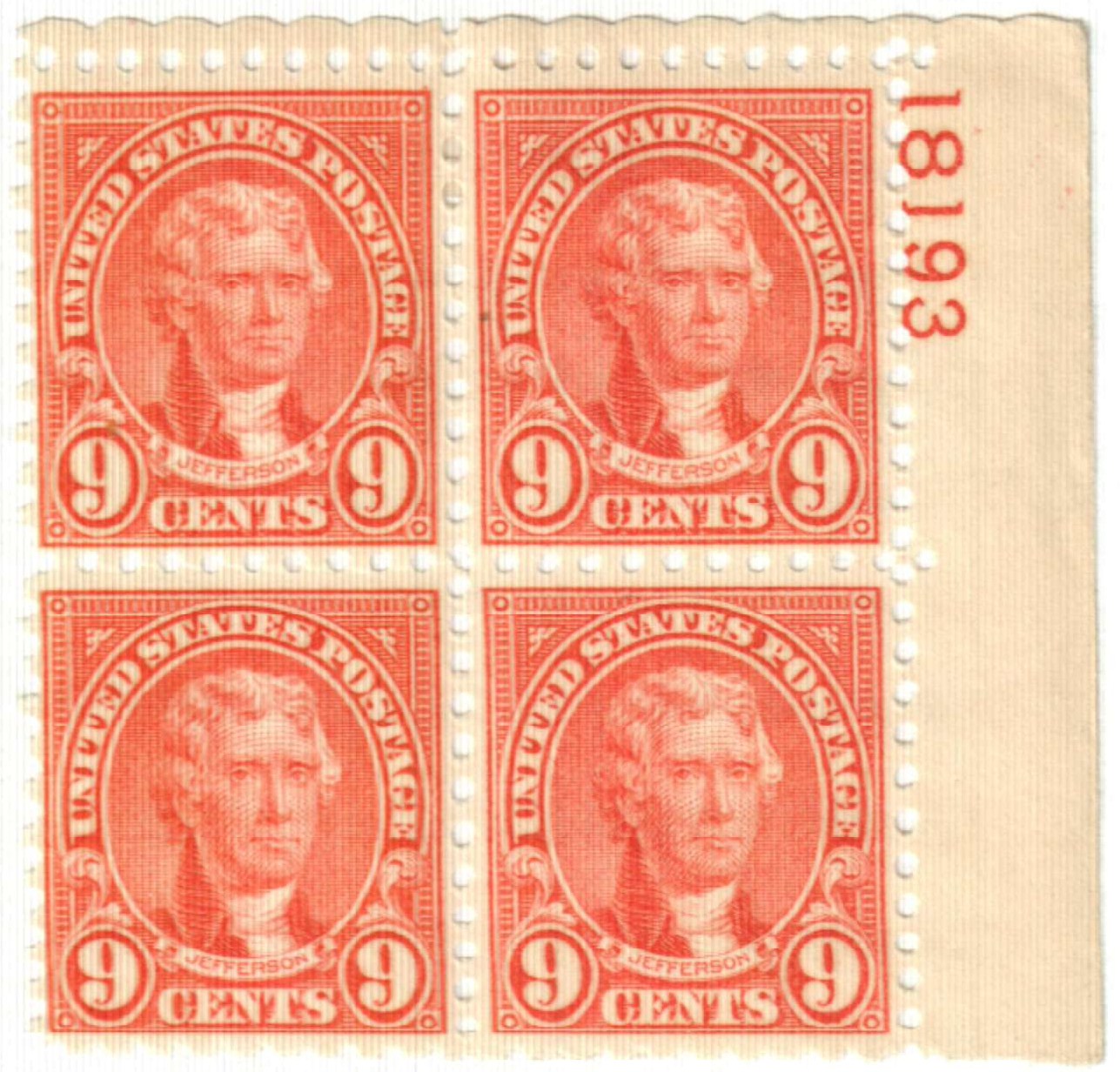
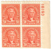
Mint Plate Block
Ships in 1-3 business days.
Ships in 1-3 business days.
$ 160.00
|
$ 160.00 |
|
|
|
Mint Stamp(s)
Ships in 1-3 business days.
Ships in 1-3 business days.
$ 10.00
|
$ 10.00 |
|
|
|
Mint Stamp(s)
Fine
Ships in 1-3 business days.
Ships in 1-3 business days.
$ 12.00
|
$ 12.00 |
|
|

|
Mint Sheet(s)
Ships in 1-3 business days.
Ships in 1-3 business days.
$ 1,125.00
|
$ 1,125.00 |
|
|
|
Mint Stamp(s)
Very Fine
Ships in 1-3 business days.
Ships in 1-3 business days.
$ 14.50
|
$ 14.50 |
|
|
|
Used Single Stamp(s)
Ships in 1-3 business days.
Ships in 1-3 business days.
Free with 1,240 Points
$ 3.95
|
$ 3.95 |
|
|
|
Used Single Stamp(s)
Fine
Ships in 1-3 business days.
Ships in 1-3 business days.
$ 4.50
|
$ 4.50 |
|
|
|
|
Unused Stamp(s)
small flaws
Ships in 1-3 business days.
Ships in 1-3 business days.
$ 6.00
|
$ 6.00 |
|
|
|
|
Used Stamp(s)
small flaws
Ships in 1-3 business days.
Ships in 1-3 business days.
Free with 750 Points
$ 2.50
|
$ 2.50 |
|
|
|
|
Unused Plate Block
small flaws
Ships in 1-3 business days.
Ships in 1-3 business days.
$ 110.00
|
$ 110.00 |
|
|

|
Mint Stamp(s)
Fine, Never Hinged
Ships in 1-3 business days.
Ships in 1-3 business days.
$ 14.50
|
$ 14.50 |
|
|

|
Mint Stamp(s)
Very Fine, Never Hinged
Ships in 1-3 business days.
Ships in 1-3 business days.
$ 17.25
|
$ 17.25 |
|
Mounts - Click Here
| Mount | Price | Qty |
|---|
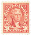
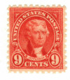
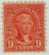
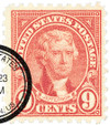
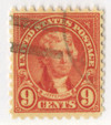
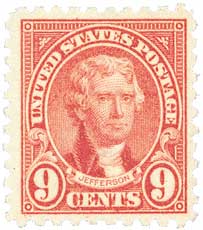
U.S. #590
Series of 1923-26 9¢ Thomas Jefferson
Issue Date: May 29, 1926
First City: Washington, D.C.
Quantity Issued: 79,537,000
Printed by: Bureau of Engraving and Printing
Printing Method: Rotary Press
Perforation: 10
Color: Rose
First City: Washington, D.C.
Quantity Issued: 79,537,000
Printed by: Bureau of Engraving and Printing
Printing Method: Rotary Press
Perforation: 10
Color: Rose
U.S. #590 was issued on the same day as the 7¢ and 8¢ stamps with little advance notice. The stamp was current for less than a year.
Founding Fathers Kept in Touch Through U.S. Mail
Thomas Jefferson, shown on U.S. #590, had a long friendship with John Adams dating back to the years before the American Revolution. That friendship suffered after the bitter Presidential Election of 1802. But in 1812, they began writing letters to each other again in what has become perhaps the most famous correspondence in American history. They discussed philosophy, religion, and world events, as well as more common topics. The two friends died within hours of each other on July 4, 1826.
Rotary Presses Lead to Faster, Cheaper Production
Prior to 1923, the rotary press had been used in the production of coil stamps. It soon became apparent this was the fastest and most economical means of printing stamps. The rotary press could print 1000 stamps at a cost of .053 cents, compared to the conventional flat bed press cost of .08 cents. This difference of .027 cents is significant when one takes into consideration the fact that the Bureau printed millions of stamps each day.
Daily production rates jumped from 1,600,000 stamps on the flat bed press to 6,000,000 per day on the rotary press. Despite the increased production and lower costs, the Post Office Department was still skeptical. They finally decided a few stamps should be printed experimentally. At first, only the 1¢ Franklin was produced and used on a trial basis for six months.
The results were successful, proving that quality was not sacrificed for higher production. Shortly thereafter, the 2¢ Washington was produced on rotary presses as well. Eventually, new equipment was developed to improve the process, which resulted in the 1¢ through 10¢ being printed on the rotary press.
National Geodetic Survey
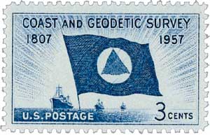
On February 10, 1807, President Thomas Jefferson signed legislation to establish the United States Survey of the Coast, which became the US Coast and Geodetic Survey and later the National Geodetic Survey.
Well before 1807, other nations had done their own coastal and geodetic surveys. Geodesy is the science of measuring the Earth’s shape, orientation in space, and gravitational field. Swiss-born Ferdinand R. Hassler immigrated to the US in 1805 and proposed the creation of a government agency to explore this field of science.
President Jefferson agreed with Hassler and signed an act into law on February 10, 1807, calling for a “Survey of the Coast.” This was America’s first scientific agency. Jefferson hoped it would aid international trade by charting US waters and making them safe for navigation. Hassler, with expertise in surveying and the standardization of weights and measures, was selected to lead the survey.
However, after Hessler submitted his plan for the survey just a month later, the Embargo Act of 1807 essentially halted all US overseas trade. The project was put on hold until 1811 when President James Madison authorized Hassler to travel to Europe to purchase the instruments needed for the survey. While Hassler was in England, the War of 1812 broke out and he was forced to stay there until it ended in 1815.

Nearly a decade after it was created, the survey finally began operations in 1816. Hassler began his work near New York City, measuring the first baseline and verifying it the following year. However, by 1818, Congress was unimpressed with the progress that had been made in the first decade of the agency and was unconvinced it was worth the cost. They fired Hassler and placed US Army and Navy officers in charge of the task. No surveys were conducted for the next 14 years.

In 1832, Congress reverted to the original law and placed the responsibility of coastal surveying back to the Survey of the Coast and authorized the hiring of civilians once again. Hassler resumed his work in 1833. In 1836, the agency was renamed the US Coast Survey. Around this time they also worked in coordination with the Navy – a new law required that survey ships be commanded and crewed by US Navy officers and men when they could provide that support.
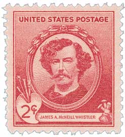
Over the years, the agency produced nautical charts, performed the first systematic study of the Gulf Stream, created tidal prediction machines, and established a geodetic connection between the Atlantic and Pacific coasts. In the 1850s, artist James McNeill Whistler worked briefly as a draughtsman for the agency. The outbreak of war would slow the work of the agency, as the US Navy and Army personnel were called away. But in peacetime, they resumed their work together. After the US acquired Alaska in 1867, the survey had even more coast to explore.
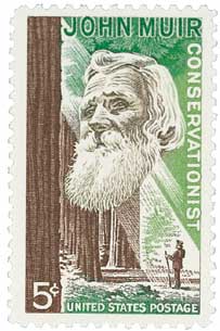
In the 1870s the agency’s responsibilities were increased to include geodetic surveys of in the country’s interior. Between 1874 and 1877, naturalist and author John Muir served as a guide and artist for the survey of the 39th Parallel. It was also during this period that the name was changed to the US Coast and Geodetic Survey.
From 1900 to 1917, the Navy was removed from the survey and it was operated entirely by civilians. Then with the US entrance into World War I, the US established the Coast and Geodetic Survey Corp, which gave the survey’s officers a commissioned status to protect them from being treated as spies if they were captured. After the war, they returned to land surveying, seafloor charting, mapping coastlines, geophysics, and oceanography. In 1926, the survey entered a new age with the passage of the Air Commerce Act, which directed them to chart US airways for the first time. During the Depression, the survey established surveying parties and field offices that provided jobs for more than 10,000 people, including many out-of-work engineers.
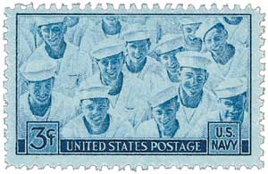
During World War II, over 1,000 members of the survey joined the war effort as hydrographers, artillery surveyors, cartographers, army engineers, intelligence officers, and geophysicists. In 1959, the survey’s charter was expanded to explore oceans worldwide. In 1970, the National Oceanic and Atmospheric Administration (NOAA) was established. The survey was merged with other agencies and became the National Geodetic Survey and the Office of Coast Survey. The Dictionary of American History stated that “the Survey is considered to have been one of the major birthplaces of modern American science, including many disciplines not generally associated with geodesy and hydrology. Its creation is a cornerstone of the rapid growth of science and technology and of the development of natural resources for commercial use in the United States.”
Click here for more on the Coast and Geodetic Survey.


U.S. #590
Series of 1923-26 9¢ Thomas Jefferson
Issue Date: May 29, 1926
First City: Washington, D.C.
Quantity Issued: 79,537,000
Printed by: Bureau of Engraving and Printing
Printing Method: Rotary Press
Perforation: 10
Color: Rose
First City: Washington, D.C.
Quantity Issued: 79,537,000
Printed by: Bureau of Engraving and Printing
Printing Method: Rotary Press
Perforation: 10
Color: Rose
U.S. #590 was issued on the same day as the 7¢ and 8¢ stamps with little advance notice. The stamp was current for less than a year.
Founding Fathers Kept in Touch Through U.S. Mail
Thomas Jefferson, shown on U.S. #590, had a long friendship with John Adams dating back to the years before the American Revolution. That friendship suffered after the bitter Presidential Election of 1802. But in 1812, they began writing letters to each other again in what has become perhaps the most famous correspondence in American history. They discussed philosophy, religion, and world events, as well as more common topics. The two friends died within hours of each other on July 4, 1826.
Rotary Presses Lead to Faster, Cheaper Production
Prior to 1923, the rotary press had been used in the production of coil stamps. It soon became apparent this was the fastest and most economical means of printing stamps. The rotary press could print 1000 stamps at a cost of .053 cents, compared to the conventional flat bed press cost of .08 cents. This difference of .027 cents is significant when one takes into consideration the fact that the Bureau printed millions of stamps each day.
Daily production rates jumped from 1,600,000 stamps on the flat bed press to 6,000,000 per day on the rotary press. Despite the increased production and lower costs, the Post Office Department was still skeptical. They finally decided a few stamps should be printed experimentally. At first, only the 1¢ Franklin was produced and used on a trial basis for six months.
The results were successful, proving that quality was not sacrificed for higher production. Shortly thereafter, the 2¢ Washington was produced on rotary presses as well. Eventually, new equipment was developed to improve the process, which resulted in the 1¢ through 10¢ being printed on the rotary press.
National Geodetic Survey
On February 10, 1807, President Thomas Jefferson signed legislation to establish the United States Survey of the Coast, which became the US Coast and Geodetic Survey and later the National Geodetic Survey.
Well before 1807, other nations had done their own coastal and geodetic surveys. Geodesy is the science of measuring the Earth’s shape, orientation in space, and gravitational field. Swiss-born Ferdinand R. Hassler immigrated to the US in 1805 and proposed the creation of a government agency to explore this field of science.
President Jefferson agreed with Hassler and signed an act into law on February 10, 1807, calling for a “Survey of the Coast.” This was America’s first scientific agency. Jefferson hoped it would aid international trade by charting US waters and making them safe for navigation. Hassler, with expertise in surveying and the standardization of weights and measures, was selected to lead the survey.
However, after Hessler submitted his plan for the survey just a month later, the Embargo Act of 1807 essentially halted all US overseas trade. The project was put on hold until 1811 when President James Madison authorized Hassler to travel to Europe to purchase the instruments needed for the survey. While Hassler was in England, the War of 1812 broke out and he was forced to stay there until it ended in 1815.
Nearly a decade after it was created, the survey finally began operations in 1816. Hassler began his work near New York City, measuring the first baseline and verifying it the following year. However, by 1818, Congress was unimpressed with the progress that had been made in the first decade of the agency and was unconvinced it was worth the cost. They fired Hassler and placed US Army and Navy officers in charge of the task. No surveys were conducted for the next 14 years.
In 1832, Congress reverted to the original law and placed the responsibility of coastal surveying back to the Survey of the Coast and authorized the hiring of civilians once again. Hassler resumed his work in 1833. In 1836, the agency was renamed the US Coast Survey. Around this time they also worked in coordination with the Navy – a new law required that survey ships be commanded and crewed by US Navy officers and men when they could provide that support.
Over the years, the agency produced nautical charts, performed the first systematic study of the Gulf Stream, created tidal prediction machines, and established a geodetic connection between the Atlantic and Pacific coasts. In the 1850s, artist James McNeill Whistler worked briefly as a draughtsman for the agency. The outbreak of war would slow the work of the agency, as the US Navy and Army personnel were called away. But in peacetime, they resumed their work together. After the US acquired Alaska in 1867, the survey had even more coast to explore.
In the 1870s the agency’s responsibilities were increased to include geodetic surveys of in the country’s interior. Between 1874 and 1877, naturalist and author John Muir served as a guide and artist for the survey of the 39th Parallel. It was also during this period that the name was changed to the US Coast and Geodetic Survey.
From 1900 to 1917, the Navy was removed from the survey and it was operated entirely by civilians. Then with the US entrance into World War I, the US established the Coast and Geodetic Survey Corp, which gave the survey’s officers a commissioned status to protect them from being treated as spies if they were captured. After the war, they returned to land surveying, seafloor charting, mapping coastlines, geophysics, and oceanography. In 1926, the survey entered a new age with the passage of the Air Commerce Act, which directed them to chart US airways for the first time. During the Depression, the survey established surveying parties and field offices that provided jobs for more than 10,000 people, including many out-of-work engineers.
During World War II, over 1,000 members of the survey joined the war effort as hydrographers, artillery surveyors, cartographers, army engineers, intelligence officers, and geophysicists. In 1959, the survey’s charter was expanded to explore oceans worldwide. In 1970, the National Oceanic and Atmospheric Administration (NOAA) was established. The survey was merged with other agencies and became the National Geodetic Survey and the Office of Coast Survey. The Dictionary of American History stated that “the Survey is considered to have been one of the major birthplaces of modern American science, including many disciplines not generally associated with geodesy and hydrology. Its creation is a cornerstone of the rapid growth of science and technology and of the development of natural resources for commercial use in the United States.”
Click here for more on the Coast and Geodetic Survey.